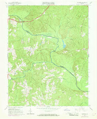
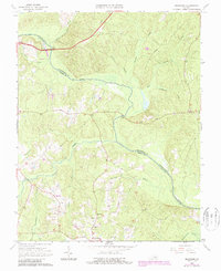
1964 Map of Mannboro
USGS Topo · Published 1969About this map
The Appomattox River carves a winding path across this rural landscape, serving as the natural boundary between Chesterfield and Amelia Counties. During the mid-1960s, the area around Mannboro maintained its agricultural character, evidenced by the scattered farmsteads and numerous small waterways like Deep Run and Winticomack Creek that drain into the main river valley. This survey reveals a community anchored by local institutions, including the Amelia Academy and several rural centers of worship and education such as Oak Grove Ch and the nearby Oak Grove Sch. Historic crossings like Goodes Bridge and Bevils Bridge remain vital links in the regional road network. The map detail highlights the intricate drainage systems of the Virginia Piedmont, where small streams like Sweathouse Creek and Beaverpond Creek define the local topography.
Find a feature on this map
24 named features on this map. Tap any name to fly to it.
Don’t see what you’re looking for? This feature index may not catch every label — zoom into the map to look around manually.
Map Details
Editions of this 1964 Mannboro Map
5 editions found
Other maps of this area

1897 · Amelia
USGS Topo · 1:125,000

1943 · Amelia
USGS Topo · 1:31,680

1943 · Goodes Bridge
USGS Topo · 1:31,680

1943 · Hallsboro
USGS Topo · 1:31,680

1943 · Clayville
USGS Topo · 1:24,000

1943 · Church Road
USGS Topo · 1:24,000

1943 · Winterpock
USGS Topo · 1:24,000
1943 · Chula
USGS Topo · 1:24,000

1943 · Richmond
USGS Topo · 1:250,000

1944 · Chula
USGS Topo · 1:31,680