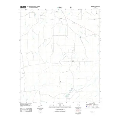
2010 Map of Manning
USGS Topo · Published 2010About this map
Manning sits at the heart of this East Texas landscape, shaped by a network of creeks and small impoundments. The community is closely tied to its water resources, with the Millpond and Club Lake situated near the M M Flournoy Dam and Manning Club Lake Dam. The terrain is defined by low-lying drainages including Brushy Creek, Possum Trot Creek, and Shawnee Creek, which cut through the piney woods. To the north, Shawnee Prairie represents a distinct opening in the timbered landscape.
Find a feature on this map
52 named features on this map. Tap any name to fly to it.
Don’t see what you’re looking for? This feature index may not catch every label — zoom into the map to look around manually.
Map Details
Editions of this 2010 Manning Map
This is the sole edition of this map. No revisions or reprints were ever made.
Other maps of this area

1927 · Lufkin 4-c
USGS Topo · 1:24,000

1928 · Zavalla 3-c
USGS Topo · 1:24,000

1928 · Lufkin 4-d
USGS Topo · 1:24,000

1931 · Zavalla
USGS Topo · 1:62,500

1932 · Manning
USGS Topo · 1:62,500

1949 · Lufkin
USGS Topo · 1:62,500

1949 · Lufkin
USGS Topo · 1:24,000

1949 · Huntington
USGS Topo · 1:24,000

1950 · Lufkin
USGS Topo · 1:24,000

1950 · Huntington
USGS Topo · 1:24,000