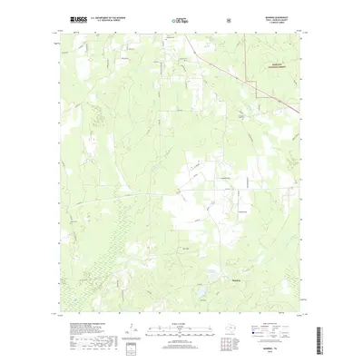
2019 Map of Manning
USGS Topo · Published 2019About this map
Manning lies at the heart of this landscape in the southern reaches of Angelina National Forest, where the terrain is defined by a dense network of creek drainages and historic family landmarks. This 2019 survey captures a rural Texas landscape deeply tied to its water sources, from the Manning Mill Ponds and Club Lake to the meandering courses of Brushy Creek and Possum Trot Creek. Local family history is well-preserved through numerous burial sites, including Renfro Cemetery, Treadwell Cemetery, Carrell Cemetery, and Shawnee Creek Cemetery. The infrastructure reveals a transition from early timber and agricultural roots to modern accessibility, with logging routes like Co Logging Rd and Flournoy Rd cutting through the forested blocks. The presence of Bufords Field and named heights like Bill Hill further ground the map in the specific geography of Angelina County.
Find a feature on this map
61 named features on this map. Tap any name to fly to it.
Don’t see what you’re looking for? This feature index may not catch every label — zoom into the map to look around manually.
Map Details
Editions of this 2019 Manning Map
This is the sole edition of this map. No revisions or reprints were ever made.
Other maps of this area

1927 · Lufkin 4-c
USGS Topo · 1:24,000

1928 · Zavalla 3-c
USGS Topo · 1:24,000

1928 · Lufkin 4-d
USGS Topo · 1:24,000

1931 · Zavalla
USGS Topo · 1:62,500

1932 · Manning
USGS Topo · 1:62,500

1949 · Lufkin
USGS Topo · 1:62,500

1949 · Lufkin
USGS Topo · 1:24,000

1949 · Huntington
USGS Topo · 1:24,000

1950 · Lufkin
USGS Topo · 1:24,000

1950 · Huntington
USGS Topo · 1:24,000