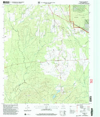
2003 Map of Manning
USGS Topo · Published 2004About this map
Manning lies at the heart of this East Texas timberland, where the presence of a Millpond and Club Lake indicates the area's industrial and recreational history within the Angelina National Forest. The landscape is a network of small drainages including Buck Creek, Caney Creek, and Shawnee Creek, which define the settlement patterns of rural communities like Shawnee Prairie. For genealogists and local historians, the sheet is exceptionally well-marked with family and community burial sites, including the Salem Ch Treadwell Cem, Garrett Cem, Renfro Cem, and Shawnee Creek Cem. These landmarks, along with small country churches such as James Chapel and Lala Hill Ch, provide a clear view of the social geography of Angelina County. The terrain is characterized by modest rises like Bill Hill and Lala Hill, surrounded by a dense web of forestry roads and local routes like Ozias Road and B W Horton Road.
Find a feature on this map
31 named features on this map. Tap any name to fly to it.
Don’t see what you’re looking for? This feature index may not catch every label — zoom into the map to look around manually.
Map Details
Editions of this 2003 Manning Map
This is the sole edition of this map. No revisions or reprints were ever made.
Other maps of this area

1927 · Lufkin 4-c
USGS Topo · 1:24,000

1928 · Zavalla 3-c
USGS Topo · 1:24,000

1928 · Lufkin 4-d
USGS Topo · 1:24,000

1931 · Zavalla
USGS Topo · 1:62,500

1932 · Manning
USGS Topo · 1:62,500

1949 · Lufkin
USGS Topo · 1:62,500

1949 · Lufkin
USGS Topo · 1:24,000

1949 · Huntington
USGS Topo · 1:24,000

1950 · Lufkin
USGS Topo · 1:24,000

1950 · Huntington
USGS Topo · 1:24,000