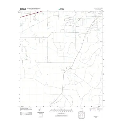
2012 Map of Manning
USGS Topo · Published 2012About this map
The settlement of Manning serves as a central point in this Baker County landscape, where rural roads and family-named routes branch out across the north Florida flatwoods. In the early 2010s, the area's development follows a grid of local lanes like Clet Harvey Rd and Fred Perry Rd, reflecting the deep-rooted genealogical history of the region. The drainage of the S Prong Saint Marys River meanders across the upper half of the quadrangle, joined by smaller tributaries like Oak Br. To the north, the Mantown Cem stands as a significant landmark for researchers tracing local families. Further south, the community of Sapp and the headwaters of the New River define the transition between the St. Marys and Suwannee drainage basins, illustrating the delicate hydrology of the Florida interior.
Find a feature on this map
57 named features on this map. Tap any name to fly to it.
Don’t see what you’re looking for? This feature index may not catch every label — zoom into the map to look around manually.
Map Details
Editions of this 2012 Manning Map
This is the sole edition of this map. No revisions or reprints were ever made.
Other maps of this area

1917 · Macclenny
USGS Topo · 1:62,500

1918 · Lawtey
USGS Topo · 1:62,500

1918 · Macclenny
USGS Topo · 1:62,500

1954 · Valdosta
USGS Topo · 1:250,000

1958 · Valdosta
USGS Topo · 1:250,000

1959 · Valdosta
USGS Topo · 1:250,000

1963 · Sanderson South
USGS Topo · 1:24,000

1966 · Lake Butler
USGS Topo · 1:24,000

1969 · Sanderson North
USGS Topo · 1:24,000
1970 · Lawtey
USGS Topo · 1:24,000