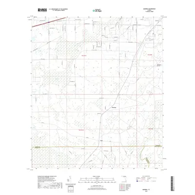
2018 Map of Manning
USGS Topo · Published 2018About this map
Manning and Sapp anchor a landscape defined by the intricate hydrology of North Florida, where the Prong Saint Marys River and New River drain extensive wetland systems. This 2018 survey documents a region dominated by vast expanses like Mud Lake Swamp and New River Swamp, which dictate the rural road patterns and settlement boundaries. The northern reaches include Hells Bay and the Mantown Cem, providing key points of interest for genealogists and local historians tracking family roots near the Baker and Union County line. The map reveals a transition from these dense swamps to the small settlement at Steckert in the east, following the path of Co Rd 125 as it traverses the low-lying terrain of Turkey Creek Swamp.
Find a feature on this map
77 named features on this map. Tap any name to fly to it.
Don’t see what you’re looking for? This feature index may not catch every label — zoom into the map to look around manually.
Map Details
Editions of this 2018 Manning Map
This is the sole edition of this map. No revisions or reprints were ever made.
Other maps of this area

1917 · Macclenny
USGS Topo · 1:62,500

1918 · Lawtey
USGS Topo · 1:62,500

1918 · Macclenny
USGS Topo · 1:62,500

1954 · Valdosta
USGS Topo · 1:250,000

1958 · Valdosta
USGS Topo · 1:250,000

1959 · Valdosta
USGS Topo · 1:250,000

1963 · Sanderson South
USGS Topo · 1:24,000

1966 · Lake Butler
USGS Topo · 1:24,000

1969 · Sanderson North
USGS Topo · 1:24,000
1970 · Lawtey
USGS Topo · 1:24,000