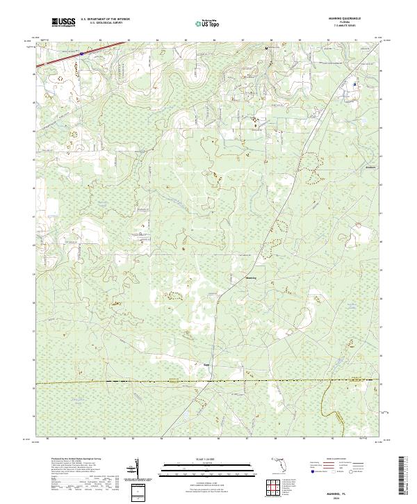
2024 Map of Manning
USGS Topo · Published 2024About this map
The small settlements of Manning and Sapp anchor this North Florida landscape, where the northern border of Baker County meets Union and Bradford counties. This terrain is defined by a dense network of hydrologic features, including the Mud Lake Swamp and the headwaters of Oak Branch. In the northern section, the Mantown Cem serves as a significant genealogical landmark for families of the rural communities surrounding Steckert. The map documents a predominantly rural infrastructure, with numerous family-named roads such as Arnold Rhoden Rd and Reid Stafford Rd branching out across the timbered lowlands. To the south, the landscape transitions into the Turkey Creek Swamp and New River Swamp, emphasizing the wet, undeveloped character of the tri-county border area where the New River flows toward the gulf drainage basin.
Find a feature on this map
78 named features on this map. Tap any name to fly to it.
Don’t see what you’re looking for? This feature index may not catch every label — zoom into the map to look around manually.
Map Details
Editions of this 2024 Manning Map
This is the sole edition of this map. No revisions or reprints were ever made.
Other maps of this area

1917 · Macclenny
USGS Topo · 1:62,500

1918 · Lawtey
USGS Topo · 1:62,500

1918 · Macclenny
USGS Topo · 1:62,500

1954 · Valdosta
USGS Topo · 1:250,000

1958 · Valdosta
USGS Topo · 1:250,000

1959 · Valdosta
USGS Topo · 1:250,000

1963 · Sanderson South
USGS Topo · 1:24,000

1966 · Lake Butler
USGS Topo · 1:24,000

1969 · Sanderson North
USGS Topo · 1:24,000
1970 · Lawtey
USGS Topo · 1:24,000