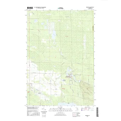
2017 Map of Manning
USGS Topo · Published 2017About this map
The Black River winds through the southern reaches of this landscape, connecting the small settlement of Manning to the northern shores of Black Lake. This 2017 survey reveals a region defined by its complex hydrology, where extensive wetlands like Alverno Swamp, Duck Marsh, and Kinsey Marsh dominate the terrain between scattered upland ridges. The northern half of the sheet is marked by long-standing infrastructure such as the Rail Road Grade Rd and Alpena St Rd, reflecting historic transit corridors through the marshy lowlands.
Find a feature on this map
70 named features on this map. Tap any name to fly to it.
Don’t see what you’re looking for? This feature index may not catch every label — zoom into the map to look around manually.
Map Details
Editions of this 2017 Manning Map
This is the sole edition of this map. No revisions or reprints were ever made.
Other maps of this area

1955 · Cheboygan
USGS Topo · 1:250,000

1957 · Tower
USGS Topo · 1:62,500

1957 · Cheboygan
USGS Topo · 1:62,500

1957 · Onaway
USGS Topo · 1:62,500

1958 · Cheboygan
USGS Topo · 1:250,000

1958 · Grace
USGS Topo · 1:62,500

1982 · Petoskey
USGS Topo · 1:100,000

1982 · Cordwood Point
USGS Topo · 1:25,000

1982 · Cheboygan
USGS Topo · 1:25,000

1982 · Grace
USGS Topo · 1:24,000