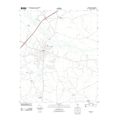
2011 Map of Manning
USGS Topo · Published 2011About this map
The Manning town center and its surrounding rural crossroads define this Clarendon County landscape at the start of the 2010s. The settlement pattern is anchored by the Manning Post Office and residential developments like High Hill Acres, while the outlying areas remain agricultural and punctuated by local junctions such as Trinity Cross Roads and Baggette Crossroads. Waterways including the Pocotaligo River and the meandering Ox Swamp cut through the territory, influencing the layout of regional thoroughfares like Frontage Rd and State Hwy S-14-532. Genealogy researchers can find several burial sites preserved across the quadrangle, notably Manning Cemetery, Trinity Cemetery, and the Fellowship Cemetery near the western edge of the survey. To the north, the community of Alcolu sits near the Harvin Pond Dam D-3489, illustrating the early 21st-century balance between municipal growth and the preservation of low-country wetlands.
Find a feature on this map
86 named features on this map. Tap any name to fly to it.
Don’t see what you’re looking for? This feature index may not catch every label — zoom into the map to look around manually.
Map Details
Editions of this 2011 Manning Map
This is the sole edition of this map. No revisions or reprints were ever made.
Other maps of this area

1920 · Mayesville
USGS Topo · 1:48,000

1920 · Manning
USGS Topo · 1:48,000

1921 · Manning
USGS Topo · 1:62,500

1921 · Mayesville
USGS Topo · 1:62,500

1943 · Mayesville
USGS Topo · 1:62,500

1944 · Manning
USGS Topo · 1:62,500

1946 · Sumter
USGS Topo · 1:62,500

1954 · Augusta
USGS Topo · 1:250,000

1957 · Sumter
USGS Topo · 1:62,500

1957 · Augusta
USGS Topo · 1:250,000