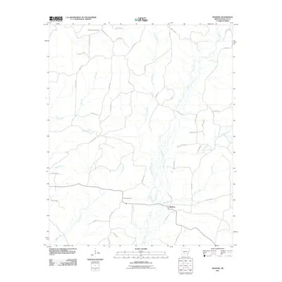
2011 Map of Manning
USGS Topo · Published 2011About this map
Manning serves as the focal point of this Dallas County landscape, situated where several local roads converge amidst a complex network of waterways. The terrain is defined by the southward flow of Little Cypress Creek and Cypress Creek, which are joined by numerous smaller tributaries like Bubler Branch and Schoolhouse Branch. This drainage pattern suggests a landscape shaped by bottomlands and intermittent stream valleys characteristic of central Arkansas.
Find a feature on this map
46 named features on this map. Tap any name to fly to it.
Don’t see what you’re looking for? This feature index may not catch every label — zoom into the map to look around manually.
Map Details
Editions of this 2011 Manning Map
This is the sole edition of this map. No revisions or reprints were ever made.
Other maps of this area

1903 · Camden
USGS Topo · 1:125,000

1953 · El Dorado
USGS Topo · 1:250,000

1955 · Little Rock
USGS Topo · 1:250,000

1956 · Little Rock
USGS Topo · 1:250,000

1957 · El Dorado
USGS Topo · 1:250,000

1958 · El Dorado
USGS Topo · 1:250,000

1960 · El Dorado
USGS Topo · 1:250,000

1960 · Little Rock
USGS Topo · 1:250,000

1964 · Little Rock
USGS Topo · 1:250,000

1964 · Donaldson
USGS Topo · 1:24,000