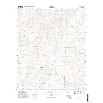
2017 Map of Manning
USGS Topo · Published 2017About this map
Manning sits at the heart of this Dallas County landscape, where the local drainage network of Cypress Cr and Little Cypress Cr dictates the rural layout. The area is defined by a dense web of creeks and branches, including Schoolhouse Br, Jordon Cr, and Black Branch, which weave between low ridges accessed by timber and local roads like Chandler Trl and Gaerther Trl. For those tracing family histories in the Arkansas timberlands, the map identifies key burial sites such as Calwell Chapel Cem in the north and DeLamar Cem further south. The land is organized by the Public Land Survey System, as seen in the prominent township and range lines for t7s r17w and t8s r16w, reflecting the long-standing agricultural and forestry divisions of the region.
Find a feature on this map
38 named features on this map. Tap any name to fly to it.
Don’t see what you’re looking for? This feature index may not catch every label — zoom into the map to look around manually.
Map Details
Editions of this 2017 Manning Map
This is the sole edition of this map. No revisions or reprints were ever made.
Other maps of this area

1903 · Camden
USGS Topo · 1:125,000

1953 · El Dorado
USGS Topo · 1:250,000

1955 · Little Rock
USGS Topo · 1:250,000

1956 · Little Rock
USGS Topo · 1:250,000

1957 · El Dorado
USGS Topo · 1:250,000

1958 · El Dorado
USGS Topo · 1:250,000

1960 · El Dorado
USGS Topo · 1:250,000

1960 · Little Rock
USGS Topo · 1:250,000

1964 · Little Rock
USGS Topo · 1:250,000

1964 · Donaldson
USGS Topo · 1:24,000