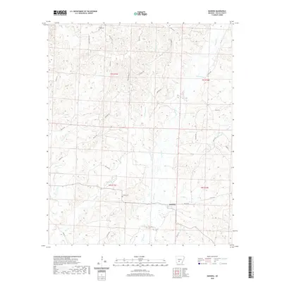
2020 Map of Manning
USGS Topo · Published 2020About this map
Manning sits at the heart of this Dallas County landscape, where the local road network follows the winding drainages of the West Gulf Coastal Plain. The topography is defined by an intricate web of seasonal streams and permanent waters, including Cypress Cr and its tributary Little Cypress Cr, which flow south through the center of the quadrangle. This 2020 survey preserves the location of historic family and community landmarks, such as the Caldwell Chapel Cem in the northwest and the DeLamar Cem further south. The naming conventions for water features like Schoolhouse Br and Black Branch suggest a legacy of early rural settlement and local industry. A dense network of forest roads and trails, including Henry Lawrence Trl and Rockwell Trl, provides access to the timberlands that surround the small clearings of the Manning community.
Find a feature on this map
36 named features on this map. Tap any name to fly to it.
Don’t see what you’re looking for? This feature index may not catch every label — zoom into the map to look around manually.
Map Details
Editions of this 2020 Manning Map
This is the sole edition of this map. No revisions or reprints were ever made.
Other maps of this area

1903 · Camden
USGS Topo · 1:125,000

1953 · El Dorado
USGS Topo · 1:250,000

1955 · Little Rock
USGS Topo · 1:250,000

1956 · Little Rock
USGS Topo · 1:250,000

1957 · El Dorado
USGS Topo · 1:250,000

1958 · El Dorado
USGS Topo · 1:250,000

1960 · El Dorado
USGS Topo · 1:250,000

1960 · Little Rock
USGS Topo · 1:250,000

1964 · Little Rock
USGS Topo · 1:250,000

1964 · Donaldson
USGS Topo · 1:24,000