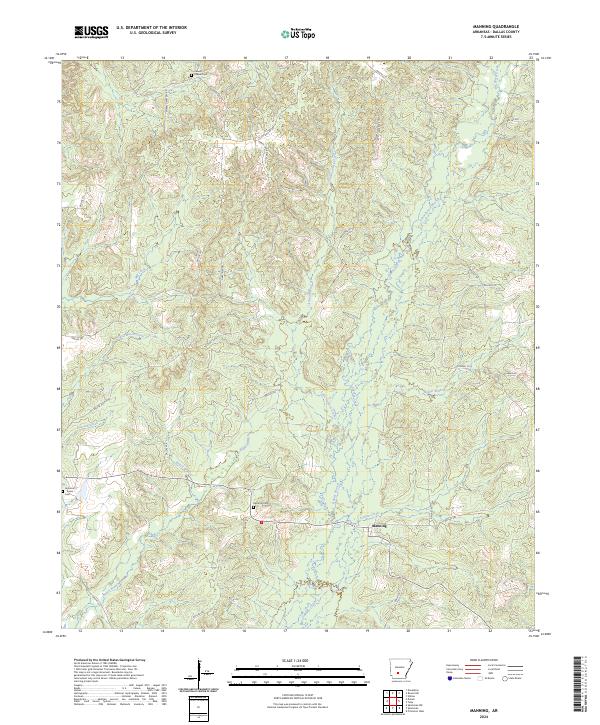
2024 Map of Manning
USGS Topo · Published 2024About this map
Manning sits at the heart of this Dallas County landscape, defined by a dense network of watercourses and family-named trails that reflect the rural character of central Arkansas. The topography is shaped by the drainage patterns of Cypress Creek and Little Cypress Creek, which flow through heavily wooded sections divided by historic land lines like t7s r17w and t8s r16w. Local history is anchored by several remote burial grounds, including the Calwell Chapel Cem in the north and the Houston-Turner Cem near the western edge. This survey documents the modern road network, where named paths like Henry Lawrence Trl and Gaertnir Trl connect scattered homesteads to local centers. The presence of Schoolhouse Branch and Bubler Branch suggests a landscape once more populated by small rural institutions and homesteads, now primarily defined by its timbered ridges and creek bottoms.
Find a feature on this map
37 named features on this map. Tap any name to fly to it.
Don’t see what you’re looking for? This feature index may not catch every label — zoom into the map to look around manually.
Map Details
Editions of this 2024 Manning Map
This is the sole edition of this map. No revisions or reprints were ever made.
Other maps of this area

1903 · Camden
USGS Topo · 1:125,000

1953 · El Dorado
USGS Topo · 1:250,000

1955 · Little Rock
USGS Topo · 1:250,000

1956 · Little Rock
USGS Topo · 1:250,000

1957 · El Dorado
USGS Topo · 1:250,000

1958 · El Dorado
USGS Topo · 1:250,000

1960 · El Dorado
USGS Topo · 1:250,000

1960 · Little Rock
USGS Topo · 1:250,000

1964 · Little Rock
USGS Topo · 1:250,000

1964 · Donaldson
USGS Topo · 1:24,000