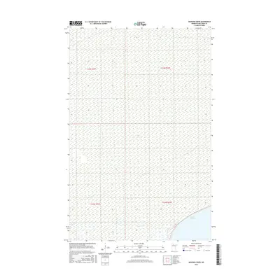
2016 Map of Manomin Creek
USGS Topo · Published 2016About this map
Upper Red Lake defines the southeastern corner of this landscape in Beltrami County, where the shoreline meets an expansive system of wetlands and low-lying terrain. The drainage of Manomin Cr moves through the southern sections of the quadrangle, carving a narrow path through the northern woods. This 2016 survey illustrates the remote character of the region, where the Public Land Survey System grid—including t155n r35w, t155n r34w, t154n r35w, and t154n r34w—provides the primary framework for navigation across the largely unpopulated territory northwest of the lake.
Find a feature on this map
6 named features on this map. Tap any name to fly to it.
Don’t see what you’re looking for? This feature index may not catch every label — zoom into the map to look around manually.
Map Details
Editions of this 2016 Manomin Creek Map
This is the sole edition of this map. No revisions or reprints were ever made.
Other maps of this area

1918 · F
USGS Topo · 1:62,500

1919 · G
USGS Topo · 1:62,500

1919 · Ponemah
USGS Topo · 1:62,500

1943 · Ponemah
USGS Topo · 1:62,500

1954 · Roseau
USGS Topo · 1:250,000

1957 · Roseau
USGS Topo · 1:250,000

1958 · Roseau
USGS Topo · 1:250,000

1973 · Manomin Creek SE
USGS Topo · 1:24,000

1973 · Mosquito Creek
USGS Topo · 1:24,000

1973 · Manomin Creek
USGS Topo · 1:24,000