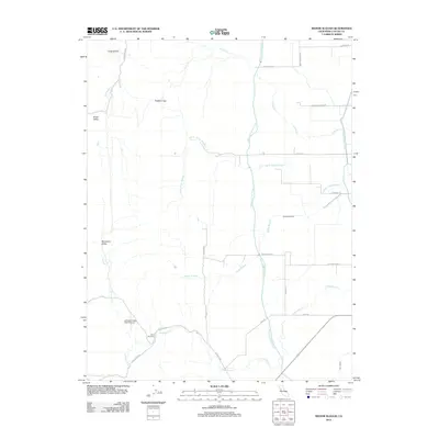
2012 Map of Manor Slough
USGS Topo · Published 2012About this map
The water infrastructure of Colusa County dominates this landscape, where the Tehama Colusa Canal and Glenn-Colusa Canal channel resources through a region defined by complex drainage patterns. Natural waterways like Manor Slough and Lurline Cr move across the valley floor, while the western portion of the map rises into the foothills, marked by distinctive terrain features such as Sulphur Gap and House Mountain. This transition from the flat agricultural basins of the Glenn Valley Slough to the upland recesses of Boxer Valley and Blanchard Valley illustrates the varied topography of the Sacramento Valley's western edge. Local aviation is represented by the Antelope Valley Ranch Airport, situated near the confluence of Leesville Rd and Freshwater Cr, serving the rural ranching and farming operations that have long shaped this part of California.
Find a feature on this map
28 named features on this map. Tap any name to fly to it.
Don’t see what you’re looking for? This feature index may not catch every label — zoom into the map to look around manually.
Map Details
Editions of this 2012 Manor Slough Map
This is the sole edition of this map. No revisions or reprints were ever made.
Other maps of this area

1904 · Sites
USGS Topo · 1:24,000

1905 · Fairview
USGS Topo · 1:24,000

1906 · Maxwell
USGS Topo · 1:62,500

1907 · Colusa
USGS Topo · 1:62,500

1917 · Sites
USGS Topo · 1:31,680

1917 · Delevan
USGS Topo · 1:31,680

1918 · Williams
USGS Topo · 1:31,680

1918 · Spring Valley
USGS Topo · 1:31,680

1920 · Venado
USGS Topo · 1:62,500

1942 · Colusa
USGS Topo · 1:62,500