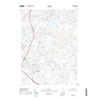
2021 Map of Mansfield
USGS Topo · Published 2021About this map
The Mansfield Center and Sharon areas are defined by a complex network of glacial ponds and small drainage systems like the Canoe River and Rumford River. The landscape is dotted with early industrial markers, such as Glue Factory Pond and Hammer Shop Pond, which point to the historic manufacturing past of these Norfolk County communities. The map highlights the suburban development around Massapoag Lake and Sharon Heights, juxtaposed with significant recreation and preservation corridors. Of particular note for researchers are the numerous family-named burial sites and historic cemeteries, including the George Drake Burial Ground and the Willis Graveyard. These features, alongside the Old Colony Rail-Trl and Bay Circuit Trl, illustrate how the region has transitioned from a mill-driven economy into a modern residential corridor while maintaining its original topographical character.
Find a feature on this map
78 named features on this map. Tap any name to fly to it.
Don’t see what you’re looking for? This feature index may not catch every label — zoom into the map to look around manually.
Map Details
Editions of this 2021 Mansfield Map
This is the sole edition of this map. No revisions or reprints were ever made.
Other maps of this area

1885 · Taunton
USGS Topo · 1:62,500

1886 · Dedham
USGS Topo · 1:62,500

1887 · Franklin
USGS Topo · 1:62,500

1887 · Providence
USGS Topo · 1:62,500

1888 · Taunton
USGS Topo · 1:62,500

1889 · Providence
USGS Topo · 1:62,500

1889 · Franklin
USGS Topo · 1:62,500

1893 · Taunton
USGS Topo · 1:62,500

1893 · Franklin
USGS Topo · 1:62,500

1894 · Dedham
USGS Topo · 1:62,500