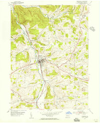
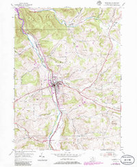
1954 Map of Mansfield
USGS Topo · Published 1956About this map
The State Teachers College and the borough of Mansfield form the center of this Tioga County valley, where the Tioga River flows north toward the New York border. The mid-century landscape is defined by the convergence of the Erie RR and major corridors like the Roosevelt Highway. Outside the main settlement, the area is punctuated by small clusters of activity at Canoe Camp, Kellytown, and Lambs Creek.
Find a feature on this map
40 named features on this map. Tap any name to fly to it.
Don’t see what you’re looking for? This feature index may not catch every label — zoom into the map to look around manually.
Map Details
Editions of this 1954 Mansfield Map
5 editions found
Other maps of this area

1900 · Tioga
USGS Topo · 1:62,500

1902 · Tioga
USGS Topo · 1:62,500

1925 · Blossburg
USGS Topo · 1:62,500

1927 · Blossburg
USGS Topo · 1:62,500

1931 · Troy
USGS Topo · 1:48,000

1938 · Troy
USGS Topo · 1:62,500

1942 · Canton
USGS Topo · 1:62,500

1944 · Blossburg
USGS Topo · 1:62,500

1944 · Canton
USGS Topo · 1:62,500

1953 · Roseville
USGS Topo · 1:24,000
Featured Places
- Mansfield, PA
- Putnam Township, PA
- Tioga Township, PA
- Lawrence Corners, Rutland Township
- Paisley, Mansfield