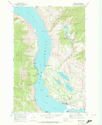
1968 Map of Manson
USGS Topo · Published 1973About this map
Lake Chelan dominates this late-1960s landscape, its deep waters serving as a primary corridor for a ferry and local transport. Along the eastern shore, the community of Manson is depicted with its residential street grid including Chase St and Madeline Rd, anchored by the local High Sch. The surrounding terrain reflects a complex water management system necessary for the region's development, featuring an aqueduct, a siphon, and a Pumping Station.
Find a feature on this map
65 named features on this map. Tap any name to fly to it.
Don’t see what you’re looking for? This feature index may not catch every label — zoom into the map to look around manually.
Map Details
Editions of this 1968 Manson Map
2 editions found
Other maps of this area

1899 · Methow
USGS Topo · 1:125,000

1901 · Chelan
USGS Topo · 1:125,000

1901 · Methow
USGS Topo · 1:125,000

1955 · Concrete
USGS Topo · 1:250,000

1957 · Wenatchee
USGS Topo · 1:250,000

1958 · Concrete
USGS Topo · 1:250,000

1962 · Concrete
USGS Topo · 1:250,000

1968 · Chelan
USGS Topo · 1:24,000

1968 · South Navarre Peak
USGS Topo · 1:24,000
1968 · Cooper Ridge
USGS Topo · 1:24,000