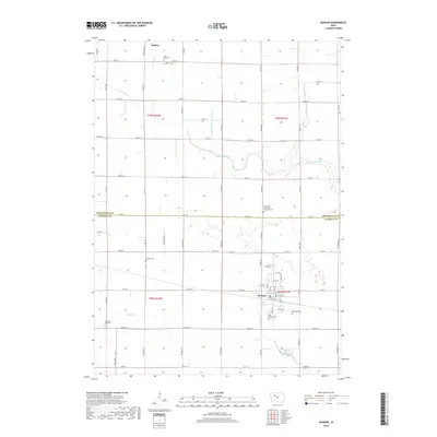
2018 Map of Manson
USGS Topo · Published 2018About this map
The agrarian landscape of the Pocahontas and Calhoun county line is defined by the settlements of Manson and Palmer. This 2018 survey reveals a well-organized grid of township roads and section lines, emphasizing the area's agricultural foundation. Water management is a prominent feature, with Drainage Ditch Number 47 and the meandering S Br Lizard Cr crossing the fertile plains. The map is particularly valuable for genealogical research, documenting numerous community burial grounds including Saint Thomas Cem, Rose Hill Cem, and the Swedish Cem. These sites, along with the Saint Pauls American Lutheran Cem, reflect the cultural heritage of the early settlers who established these communities along the drainage basins of Lake Cr and E Cedar Cr. The proximity of these towns to the county border highlights the interconnected nature of regional development in north-central Iowa.
Find a feature on this map
64 named features on this map. Tap any name to fly to it.
Don’t see what you’re looking for? This feature index may not catch every label — zoom into the map to look around manually.
Map Details
Editions of this 2018 Manson Map
This is the sole edition of this map. No revisions or reprints were ever made.
Other maps of this area

1954 · Fort Dodge
USGS Topo · 1:250,000

1957 · Fort Dodge
USGS Topo · 1:250,000

1958 · Fort Dodge
USGS Topo · 1:250,000

1965 · Knierim
USGS Topo · 1:24,000

1979 · Pocahontas
USGS Topo · 1:24,000

1979 · Gilmore City SW
USGS Topo · 1:24,000

1979 · Manson
USGS Topo · 1:24,000

1979 · Pomeroy
USGS Topo · 1:24,000

1979 · Gilmore City
USGS Topo · 1:24,000

1979 · Palmer
USGS Topo · 1:24,000