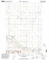
1998 Map of Mantador
USGS Topo · Published 2000About this map
The Wild Rice River snakes across the southern reaches of this Richland County landscape, defining the northern boundary of the Sheyenne National Grassland. This 1990s revision captures the rural character of southeastern North Dakota, where the town of Mantador serves as a central hub for the surrounding townships of Barney, Mooreton, Belford, and Brandenburg.
Find a feature on this map
13 named features on this map. Tap any name to fly to it.
Don’t see what you’re looking for? This feature index may not catch every label — zoom into the map to look around manually.
Map Details
Editions of this 1998 Mantador Map
This is the sole edition of this map. No revisions or reprints were ever made.
Other maps of this area

1904 · Wahpeton
USGS Topo · 1:125,000

1907 · Wyndmere
USGS Topo · 1:125,000

1953 · Fargo
USGS Topo · 1:250,000

1956 · Fargo
USGS Topo · 1:250,000

1960 · Mooreton West
USGS Topo · 1:24,000

1960 · Wyndmere SE
USGS Topo · 1:24,000

1960 · Mooreton East
USGS Topo · 1:24,000

1964 · Hankinson
USGS Topo · 1:24,000

1964 · Mantador
USGS Topo · 1:24,000

1964 · Moselle
USGS Topo · 1:24,000