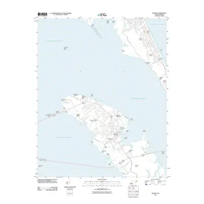
2011 Map of Manteo
USGS Topo · Published 2011About this map
Roanoke Island serves as the central focus of this coastal study, positioned between Roanoke Sound and Croatan Sound. The town of Manteo is the primary hub of activity, featuring the Turn Basin and the Ananias Dare Street Bridge spanning Doughs Creek. To the north, the commemorative landscape of Fort Raleigh City includes the Elizabethan Gardens and the site of the Mother Vineyard, reflecting the deep colonial roots of the Outer Banks.
Find a feature on this map
57 named features on this map. Tap any name to fly to it.
Don’t see what you’re looking for? This feature index may not catch every label — zoom into the map to look around manually.
Map Details
Editions of this 2011 Manteo Map
This is the sole edition of this map. No revisions or reprints were ever made.
Other maps of this area

1940 · Kitty Hawk
USGS Topo · 1:62,500

1940 · Powells Point
USGS Topo · 1:62,500

1943 · Roanoke Island
USGS Topo · 1:125,000

1946 · Eastville
USGS Topo · 1:250,000

1946 · Currituck Sound
USGS Topo · 1:250,000

1953 · Wanchese
USGS Topo · 1:24,000

1953 · Roanoke Island NE
USGS Topo · 1:24,000

1953 · Manteo
USGS Topo · 1:24,000

1953 · East Lake SE
USGS Topo · 1:24,000

1953 · Manns Harbor
USGS Topo · 1:24,000