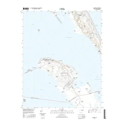
2016 Map of Manteo
USGS Topo · Published 2016About this map
Roanoke Island and its surrounding sounds form the centerpiece of this coastal survey, where the Fort Raleigh National Historic Site preserves the site of early English settlement near Fort Raleigh City. The geography is defined by the shallow waters of Croatan Sound, Roanoke Sound, and Albemarle Sound, connected by narrow passages like Colington Cut. On the Outer Banks, the landscape transitions from the urbanized stretches of Kill Devil Hills to the natural height of Jockey Ridge and Engagement Hill. This map documents a modern infrastructure network of bridges, including the William B Umstead Memorial Bridge and the Roanoke Sound Bridge, which tie these islands to the mainland at Manns Harbor. Interior Roanoke Island features include the local neighborhoods of Mother Vineyard, California, and the historic port town of Manteo.
Find a feature on this map
110 named features on this map. Tap any name to fly to it.
Don’t see what you’re looking for? This feature index may not catch every label — zoom into the map to look around manually.
Map Details
Editions of this 2016 Manteo Map
This is the sole edition of this map. No revisions or reprints were ever made.
Other maps of this area

1940 · Kitty Hawk
USGS Topo · 1:62,500

1940 · Powells Point
USGS Topo · 1:62,500

1943 · Roanoke Island
USGS Topo · 1:125,000

1946 · Eastville
USGS Topo · 1:250,000

1946 · Currituck Sound
USGS Topo · 1:250,000

1953 · Wanchese
USGS Topo · 1:24,000

1953 · Roanoke Island NE
USGS Topo · 1:24,000

1953 · Manteo
USGS Topo · 1:24,000

1953 · East Lake SE
USGS Topo · 1:24,000

1953 · Manns Harbor
USGS Topo · 1:24,000