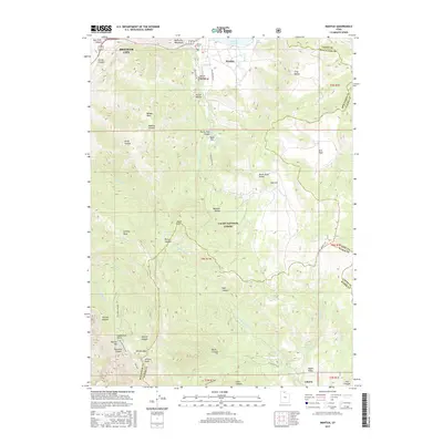
2017 Map of Mantua
USGS Topo · Published 2017About this map
The settlement of Mantua sits within a high mountain valley, anchored by the Mantua Reservoir and the Mantua Cem at the foot of the Wellsville Mountains. To the west, the urban edge of Brigham City appears at the mouth of Box Elder Canyon, where the steep mountain front rises toward Grizzly Peak and Inspiration Point. The central landscape is dominated by the Cache National Forest, a network of deep canyons such as Perry Canyon and Willard Canyon that drain toward the Great Salt Lake basin. To the southeast, the terrain descends into Ogden Valley, where the community of Liberty is situated near Utaba Reservoir. This survey highlights the complex road and trail systems of the Wasatch Range, including Skyline Dr and Willard Peak Rd, which navigate the high-elevation basins and peaks.
Find a feature on this map
68 named features on this map. Tap any name to fly to it.
Don’t see what you’re looking for? This feature index may not catch every label — zoom into the map to look around manually.
Map Details
Editions of this 2017 Mantua Map
This is the sole edition of this map. No revisions or reprints were ever made.
Other maps of this area

1914 · Logan
USGS Topo · 1:125,000

1916 · Logan
USGS Topo · 1:125,000

1954 · Ogden
USGS Topo · 1:250,000

1954 · Brigham City
USGS Topo · 1:250,000

1955 · Plain City
USGS Topo · 1:24,000

1955 · Paradise
USGS Topo · 1:24,000

1955 · Mantua
USGS Topo · 1:24,000

1955 · Huntsville
USGS Topo · 1:24,000

1955 · James Peak
USGS Topo · 1:24,000

1955 · Willard
USGS Topo · 1:24,000