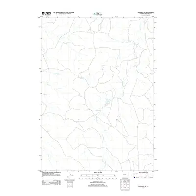
2012 Map of Manville NE
USGS Topo · Published 2012About this map
Young Woman Cr and its various tributaries define the drainage patterns of this high plains region in eastern Wyoming. The landscape is characterized by intermittent watercourses and small-scale water management projects, most notably the Magoon Number 1 Reservoir and Bast Number 1 Reservoir. These reservoirs suggest the importance of water storage for ranching and livestock in a semi-arid environment where reliable surface water is sparse. While the area is largely devoid of concentrated settlements, the presence of 28 Rd indicates the sparse network of rural routes connecting the expansive grazing lands. The map also captures the headwaters and drainages of Little Boggy Cr, Boggy Cr, and Cherry Cr, providing a detailed look at the hydrology of the Niobrara County backcountry.
Find a feature on this map
8 named features on this map. Tap any name to fly to it.
Don’t see what you’re looking for? This feature index may not catch every label — zoom into the map to look around manually.
Map Details
Editions of this 2012 Manville NE Map
This is the sole edition of this map. No revisions or reprints were ever made.
Other maps of this area

1954 · Torrington
USGS Topo · 1:250,000

1955 · Newcastle
USGS Topo · 1:250,000

1958 · Torrington
USGS Topo · 1:250,000

1958 · Newcastle
USGS Topo · 1:250,000

1981 · Telephone Draw
USGS Topo · 1:24,000

1981 · Lusk
USGS Topo · 1:24,000
1981 · Rabbit Mountains
USGS Topo · 1:24,000

1981 · Manville
USGS Topo · 1:24,000
1981 · Hat Rock
USGS Topo · 1:24,000

1981 · Bills Creek
USGS Topo · 1:24,000