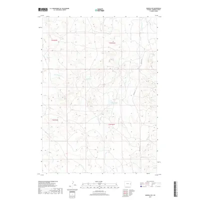
2017 Map of Manville NE
USGS Topo · Published 2017About this map
Young Woman Cr defines the drainage of this high plains landscape in Niobrara County, Wyoming. The 2017 survey reveals an area largely shaped by water management and rural access, centered on the Twentyeight Rd corridor. Notable water storage features like Bast Number 1 Reservoir and Magoon Number 1 Reservoir are distributed across the terrain, indicating the importance of irrigation and livestock watering in this arid environment. Several seasonal tributaries, including Little Boggy Cr, Cherry Cr, and the uniquely named FF Cr, etch the land between the township lines of T34N and T35N. The map provides a precise look at the drainage patterns of the N Fork Wyatte Cr and Boggy Cr, showing how these natural features intersect with the section-line grid of the American West.
Find a feature on this map
13 named features on this map. Tap any name to fly to it.
Don’t see what you’re looking for? This feature index may not catch every label — zoom into the map to look around manually.
Map Details
Editions of this 2017 Manville NE Map
This is the sole edition of this map. No revisions or reprints were ever made.
Other maps of this area

1954 · Torrington
USGS Topo · 1:250,000

1955 · Newcastle
USGS Topo · 1:250,000

1958 · Torrington
USGS Topo · 1:250,000

1958 · Newcastle
USGS Topo · 1:250,000

1981 · Telephone Draw
USGS Topo · 1:24,000

1981 · Lusk
USGS Topo · 1:24,000
1981 · Rabbit Mountains
USGS Topo · 1:24,000

1981 · Manville
USGS Topo · 1:24,000
1981 · Hat Rock
USGS Topo · 1:24,000

1981 · Bills Creek
USGS Topo · 1:24,000