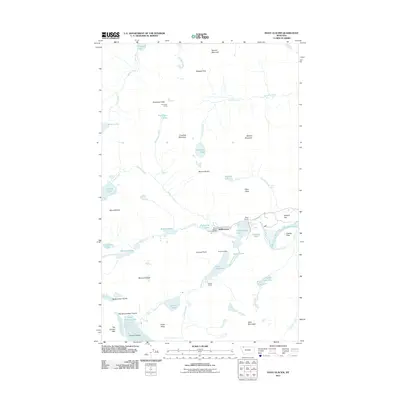
2011 Map of Many Glacier
USGS Topo · Published 2011About this map
Many Glacier and the adjacent settlement of Swiftcurrent sit at the heart of this high-altitude landscape, where glacial waters and alpine peaks define the geography. The map documents the human footprint within the wilderness, from the historic Josephine Mine near Stump Lake to the engineering of the Ptarmigan Tunnel carved through the Ptarmigan Wall. Travel through the area is anchored by Many Glacier Rd and Glacier Route 3, which provide access to the Many Glacier Campground and the Oastler Shelter.
Find a feature on this map
65 named features on this map. Tap any name to fly to it.
Don’t see what you’re looking for? This feature index may not catch every label — zoom into the map to look around manually.
Map Details
Editions of this 2011 Many Glacier Map
This is the sole edition of this map. No revisions or reprints were ever made.
Other maps of this area

1904 · Chief Mountain
USGS Topo · 1:125,000

1938 · Chief Mountain
USGS Topo · 1:125,000

1960 · Cut Bank
USGS Topo · 1:250,000

1963 · Cut Bank
USGS Topo · 1:250,000

1964 · Cut Bank
USGS Topo · 1:250,000

1968 · Ahern Pass
USGS Topo · 1:24,000
1968 · Mount Cannon
USGS Topo · 1:24,000

1968 · Gable Mountain
USGS Topo · 1:24,000
1968 · Mount Cleveland
USGS Topo · 1:24,000
1968 · Logan Pass
USGS Topo · 1:24,000