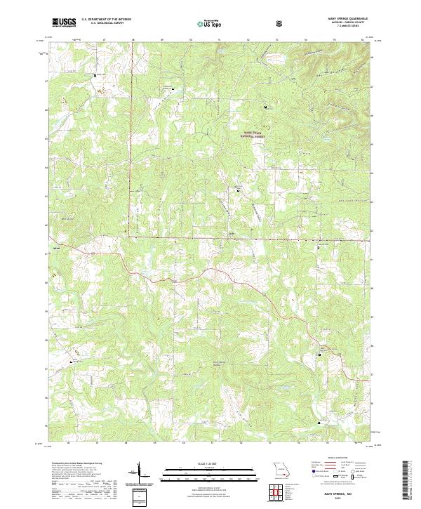
2021 Map of Many Springs
USGS Topo · Published 2021About this map
The town of Alton sits at the edge of the Mark Twain National Forest, where the landscape of Oregon County is defined by an intricate network of hollows and springs. Numerous family and community burial grounds, such as Many Springs Cem, Cave Spring Cem, and Oak Hill Cem, are scattered across the terrain, reflecting a long history of rural settlement. The northern reaches are bounded by the Eleven Point Wild and Scenic River, passing near topographic landmarks like Devils Backbone. This area, managed under the t24n r4w and t24n r3w township boundaries, demonstrates the typical Ozark pattern of deep valleys like Bat Cave Hollow and Sisco Hollow separated by ridges. Many water sources, including Williams Spring and Cave Spring, emphasize the karst geology that has historically supported small communities like Lulu.
Find a feature on this map
77 named features on this map. Tap any name to fly to it.
Don’t see what you’re looking for? This feature index may not catch every label — zoom into the map to look around manually.
Map Details
Editions of this 2021 Many Springs Map
This is the sole edition of this map. No revisions or reprints were ever made.
Other maps of this area

1931 · Bandyville
USGS Topo · 1:48,000

1941 · Gatewood
USGS Topo · 1:62,500

1944 · Van Buren
USGS Topo · 1:62,500

1944 · Couch
USGS Topo · 1:62,500

1944 · Birch Tree
USGS Topo · 1:62,500

1945 · Gatewood
USGS Topo · 1:62,500

1946 · Couch
USGS Topo · 1:62,500

1946 · Van Buren
USGS Topo · 1:62,500

1948 · Birch Tree
USGS Topo · 1:62,500

1957 · Poplar Bluff
USGS Topo · 1:250,000