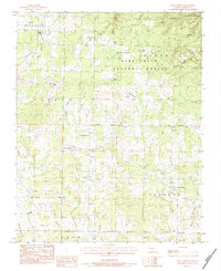
1983 Map of Many Springs
USGS Topo · Published 1984About this map
Many Springs and the surrounding Ozark landscape are documented here during the early 1980s, revealing a rural network of small communities and family landmarks. The settlement of Woodside sits in the northwest, while the southern portion is anchored by Couch and a series of rural congregations including Nebo Ch and Pleasant Ridge Ch. The topography is defined by complex drainage systems like Hurricane Creek and Sisco Creek, which feed into numerous hollows.
Find a feature on this map
57 named features on this map. Tap any name to fly to it.
Don’t see what you’re looking for? This feature index may not catch every label — zoom into the map to look around manually.
Map Details
Editions of this 1983 Many Springs Map
This is the sole edition of this map. No revisions or reprints were ever made.
Other maps of this area

1931 · Bandyville
USGS Topo · 1:48,000

1941 · Gatewood
USGS Topo · 1:62,500

1944 · Van Buren
USGS Topo · 1:62,500

1944 · Couch
USGS Topo · 1:62,500

1944 · Birch Tree
USGS Topo · 1:62,500

1945 · Gatewood
USGS Topo · 1:62,500

1946 · Couch
USGS Topo · 1:62,500

1946 · Van Buren
USGS Topo · 1:62,500

1948 · Birch Tree
USGS Topo · 1:62,500

1957 · Poplar Bluff
USGS Topo · 1:250,000