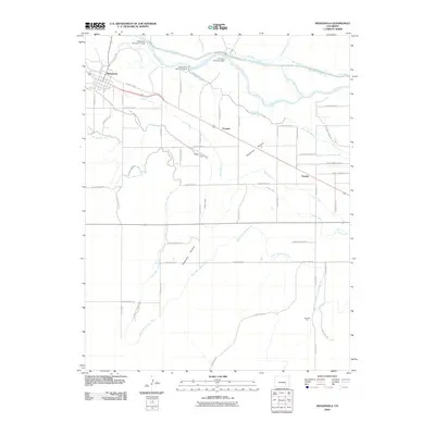
2010 Map of Manzanola
USGS Topo · Published 2010About this map
Manzanola serves as the primary hub in this eastern Colorado landscape, where the Arkansas River and an intricate network of irrigation infrastructure dictate the pattern of settlement. Small communities like Vroman and Fayette align with the transportation and water corridors that cross the plains. The map reveals the critical importance of water management through numerous structures, including the Holbrook Diversion Dam, Rocky Ford Diversion Dam, and the Fort Lyon Diversion Dam.
Find a feature on this map
47 named features on this map. Tap any name to fly to it.
Don’t see what you’re looking for? This feature index may not catch every label — zoom into the map to look around manually.
Map Details
Editions of this 2010 Manzanola Map
This is the sole edition of this map. No revisions or reprints were ever made.
Other maps of this area

1891 · Catlin
USGS Topo · 1:125,000

1891 · Timpas
USGS Topo · 1:125,000

1893 · Catlin
USGS Topo · 1:125,000

1894 · Timpas
USGS Topo · 1:125,000

1954 · Olney Springs
USGS Topo · 1:24,000

1954 · Elder
USGS Topo · 1:24,000

1954 · Sugar City
USGS Topo · 1:24,000

1954 · Ordway
USGS Topo · 1:24,000

1954 · Manzanola
USGS Topo · 1:24,000

1954 · Lamar
USGS Topo · 1:250,000