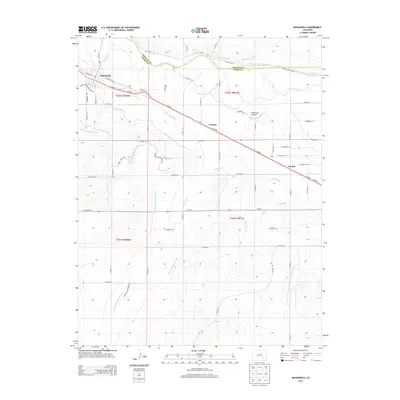
2013 Map of Manzanola
USGS Topo · Published 2013About this map
Arkansas River water rights and agricultural engineering define this landscape on the border of Otero and Crowley counties. The town of Manzanola serves as a primary hub along the Us-50 corridor, flanked by the smaller settlements of Vroman and Fayette. The map documents an incredibly dense network of irrigation infrastructure essential to High Plains farming, including the Rocky Ford Highline Canal, Catlin Canal, and Otero Canal. These man-made waterways snake across the terrain, tracing elevation contours to distribute river water far from the primary channel.
Find a feature on this map
54 named features on this map. Tap any name to fly to it.
Don’t see what you’re looking for? This feature index may not catch every label — zoom into the map to look around manually.
Map Details
Editions of this 2013 Manzanola Map
This is the sole edition of this map. No revisions or reprints were ever made.
Other maps of this area

1891 · Catlin
USGS Topo · 1:125,000

1891 · Timpas
USGS Topo · 1:125,000

1893 · Catlin
USGS Topo · 1:125,000

1894 · Timpas
USGS Topo · 1:125,000

1954 · Olney Springs
USGS Topo · 1:24,000

1954 · Elder
USGS Topo · 1:24,000

1954 · Sugar City
USGS Topo · 1:24,000

1954 · Ordway
USGS Topo · 1:24,000

1954 · Manzanola
USGS Topo · 1:24,000

1954 · Lamar
USGS Topo · 1:250,000