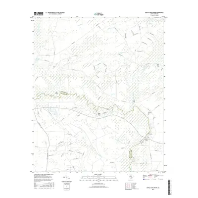
2017 Map of Maple Cane Swamp
USGS Topo · Published 2017About this map
The Edisto River meanders across this Lowcountry landscape, forming the natural boundary between Dorchester and Colleton counties. This area is defined by its extensive wetlands, including the Maple Cane Swamp, Four Hole Swamp, and Indian Field Swamp, which create a complex network of waterways like Deep Creek and Poorly Branch. The settlement of Holly Ridge serves as a local hub, surrounded by family-named sites that offer significant value for genealogical research. Numerous burial grounds are scattered throughout the region, such as Ferguson Cem, Muckenfuss Cem, and Givhans Ferry Cem. Transportation and crossing points are vital in this riverine environment, evidenced by Harleys Bridge and Givhans Bridge, as well as named landings like Mars Old Field Landing. The presence of landmarks like Rumphs Pond and Cane Island further illustrates the intersection of local industry and the natural topography of the South Carolina coastal plain.
Find a feature on this map
90 named features on this map. Tap any name to fly to it.
Don’t see what you’re looking for? This feature index may not catch every label — zoom into the map to look around manually.
Map Details
Editions of this 2017 Maple Cane Swamp Map
This is the sole edition of this map. No revisions or reprints were ever made.
Other maps of this area

1918 · Walterboro
USGS Topo · 1:62,500

1918 · Cottageville
USGS Topo · 1:62,500

1919 · Ridgeville
USGS Topo · 1:48,000

1920 · Ridgeville
USGS Topo · 1:62,500

1920 · St. George
USGS Topo · 1:48,000

1921 · St. George
USGS Topo · 1:62,500

1943 · Cottageville
USGS Topo · 1:62,500

1943 · Orangeburg
USGS Topo · 1:125,000

1943 · Walterboro
USGS Topo · 1:62,500

1943 · Ridgeville
USGS Topo · 1:62,500
Featured Places
- Mas Old Field Landing, SC
- Russell Lake Landing, SC
- Holly Ridge, SC
- Dorchester County, SC
- Colleton County, SC