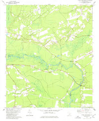
1979 Map of Maple Cane Swamp
USGS Topo · Published 1980About this map
The Edisto River snakes through the South Carolina Lowcountry, marking the boundary between Dorchester and Colleton Counties. The landscape is dominated by a complex network of wetlands and seasonal drainages, including the expansive Indian Field Swamp, Maple Cane Swamp, and Four Hole Swamp. These waterways dictated the early settlement patterns of the region, visible in the family-named landings and bridges that provided access to the river's resources.
Find a feature on this map
44 named features on this map. Tap any name to fly to it.
Don’t see what you’re looking for? This feature index may not catch every label — zoom into the map to look around manually.
Map Details
Editions of this 1979 Maple Cane Swamp Map
This is the sole edition of this map. No revisions or reprints were ever made.
Other maps of this area

1918 · Walterboro
USGS Topo · 1:62,500

1918 · Cottageville
USGS Topo · 1:62,500

1919 · Ridgeville
USGS Topo · 1:48,000

1920 · Ridgeville
USGS Topo · 1:62,500

1920 · St. George
USGS Topo · 1:48,000

1921 · St. George
USGS Topo · 1:62,500

1943 · Cottageville
USGS Topo · 1:62,500

1943 · Orangeburg
USGS Topo · 1:125,000

1943 · Walterboro
USGS Topo · 1:62,500

1943 · Ridgeville
USGS Topo · 1:62,500
Featured Places
- Russell Lake Landing, SC
- Mas Old Field Landing, SC
- Holly Ridge, SC
- Dorchester County, SC
- Colleton County, SC