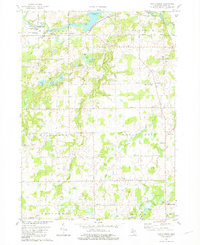
1981 Map of Maple Grove
USGS Topo · Published 1981About this map
Thornapple River and Thornapple Lake dominate the northern landscape of this Barry County region, where the town of Quimby sits near the riverbanks. The 1981 terrain is marked by a high density of rural social and spiritual anchors, including the Maple Leaf Grange Hall and several community burial grounds like Union Cem and the German Evangelical Cem. The survey reveals a landscape transitioning from the recreational shores of Charlton Park to the agricultural reaches of Maple Grove and Baltimore townships.
Find a feature on this map
64 named features on this map. Tap any name to fly to it.
Don’t see what you’re looking for? This feature index may not catch every label — zoom into the map to look around manually.
Map Details
Editions of this 1981 Maple Grove Map
This is the sole edition of this map. No revisions or reprints were ever made.
Other maps of this area

1918 · Battle Creek
USGS Topo · 1:62,500

1918 · Galesburg
USGS Topo · 1:62,500

1943 · Battle Creek
USGS Topo · 1:62,500

1944 · Galesburg
USGS Topo · 1:62,500

1947 · Banfield
USGS Topo · 1:24,000

1947 · Bellevue
USGS Topo · 1:24,000

1947 · Bedford
USGS Topo · 1:24,000

1947 · Galesburg
USGS Topo · 1:62,500

1950 · Galesburg
USGS Topo · 1:62,500

1950 · Battle Creek
USGS Topo · 1:62,500