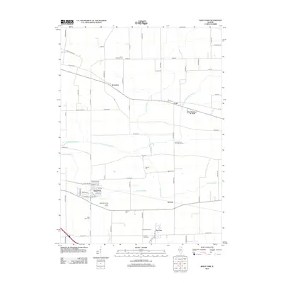
2012 Map of Maple Park
USGS Topo · Published 2012About this map
Maple Park serves as the primary hub in this agricultural landscape, situated along the southern portion of the quadrangle. The surrounding countryside is defined by a systematic grid of rural roads and a series of drainage ditches, including Virgil Ditch Number 1 and Union Ditch Number 2, which manage the flow toward the East Branch South Branch Kishwaukee River. For genealogists and local historians, the sheet is particularly valuable for its documentation of numerous burial grounds scattered across the townships, such as Saints Peter and Paul's Catholic Cem, Old Saint Mary's Cem, and Thatcher Cem. Smaller nodes like Richardson, Virgil, and Meredith mark the intersections of the rural economy, while the Miller/Maple Park Farm Airport and Kuipers Family Farm highlight the evolving land use in this part of Illinois.
Find a feature on this map
77 named features on this map. Tap any name to fly to it.
Don’t see what you’re looking for? This feature index may not catch every label — zoom into the map to look around manually.
Map Details
Editions of this 2012 Maple Park Map
This is the sole edition of this map. No revisions or reprints were ever made.
Other maps of this area

1925 · Elgin
USGS Topo · 1:62,500

1932 · Geneva
USGS Topo · 1:62,500

1937 · Sycamore
USGS Topo · 1:62,500

1938 · Genoa
USGS Topo · 1:62,500

1940 · Elgin
USGS Topo · 1:62,500

1948 · Geneva
USGS Topo · 1:62,500

1954 · Rockford
USGS Topo · 1:250,000

1955 · Rockford
USGS Topo · 1:250,000

1958 · Aurora
USGS Topo · 1:250,000

1958 · Rockford
USGS Topo · 1:250,000