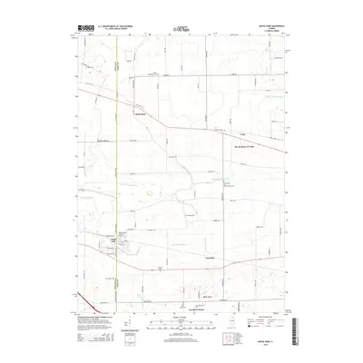
2015 Map of Maple Park
USGS Topo · Published 2015About this map
Maple Park straddles the county line at the heart of this landscape, serving as a focal point for a region defined by agricultural heritage and carefully managed water systems. The map illustrates a dense network of drainage infrastructure, including Union Ditch Number 2, Virgil Ditch Number 1, and Virgil Ditch Number 3, which support the surrounding farmland between the E Br S Br Kishwaukee River and E Br Big Rock Cr. Local history is preserved through numerous family and parish burial grounds, such as Gardner Cem, Thatcher Cem, and Saints Peter and Paul's Catholic Cem. Small residential enclaves like Richardson, Meredith, and The Meadows of Virgil show the modern settlement pattern as it coexists with rural homesteads and legacy road networks like Old State Rd.
Find a feature on this map
77 named features on this map. Tap any name to fly to it.
Don’t see what you’re looking for? This feature index may not catch every label — zoom into the map to look around manually.
Map Details
Editions of this 2015 Maple Park Map
This is the sole edition of this map. No revisions or reprints were ever made.
Other maps of this area

1925 · Elgin
USGS Topo · 1:62,500

1932 · Geneva
USGS Topo · 1:62,500

1937 · Sycamore
USGS Topo · 1:62,500

1938 · Genoa
USGS Topo · 1:62,500

1940 · Elgin
USGS Topo · 1:62,500

1948 · Geneva
USGS Topo · 1:62,500

1954 · Rockford
USGS Topo · 1:250,000

1955 · Rockford
USGS Topo · 1:250,000

1958 · Aurora
USGS Topo · 1:250,000

1958 · Rockford
USGS Topo · 1:250,000