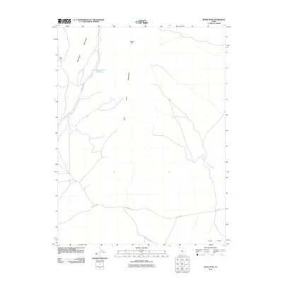
2010 Map of Maple Peak
USGS Topo · Published 2010About this map
The Sheeprock Mountains and West Tintic Mountains converge in this high-desert landscape of Juab County, Utah. The terrain is defined by drainage networks like Chambers Wash and the seasonal flow of Cherry Creek, which feeds into the Cherry Creek Reservoir. This remote area is marked by a handful of established points of human presence, including Hassel Ranch near the western boundary and the prominent elevation of Maple Peak. Transportation across this arid basin relies on isolated tracks such as Cherry Creek Rd and the Jericho Callao Rd, providing a detailed look at the rural infrastructure and ranching geography in the early twenty-first century. To the southeast, Jericho Ridge rises above the valley floor near Mud Spring, highlighting the critical importance of water sources in this Great Basin environment.
Find a feature on this map
12 named features on this map. Tap any name to fly to it.
Don’t see what you’re looking for? This feature index may not catch every label — zoom into the map to look around manually.
Map Details
Editions of this 2010 Maple Peak Map
This is the sole edition of this map. No revisions or reprints were ever made.
Other maps of this area

1885 · Sevier Desert
USGS Topo · 1:250,000

1953 · Delta
USGS Topo · 1:250,000

1954 · Mc Intyre
USGS Topo · 1:24,000

1954 · Tintic Junction
USGS Topo · 1:24,000

1958 · Delta
USGS Topo · 1:250,000

1962 · Delta
USGS Topo · 1:250,000

1962 · Lynndyl
USGS Topo · 1:62,500

1963 · Maple Peak
USGS Topo · 1:24,000
1963 · Sabie Mountain
USGS Topo · 1:24,000

1963 · Dutch Peak
USGS Topo · 1:24,000