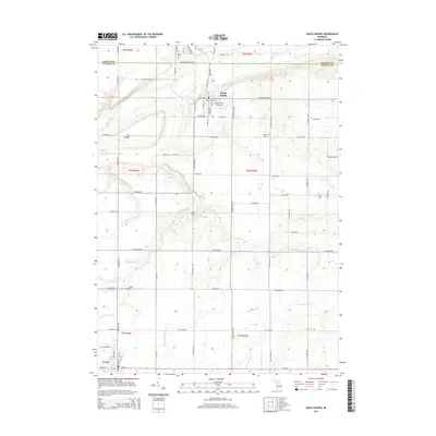
2014 Map of Maple Rapids
USGS Topo · Published 2014About this map
Maple Rapids sits at the northern edge of Clinton County, where the Maple River bends through a landscape defined by its intricate drainage network. This area, spanning the Gratiot County line, reveals a deeply agricultural character established by the mid-2010s, evidenced by the numerous named man-made waterways like Reynolds and Sessions Drain and Catlin and Waters Drain that crisscross the terrain. The village of Fowler anchors the southwestern corner of the map, connected to the north by a rigid grid of country roads.
Find a feature on this map
75 named features on this map. Tap any name to fly to it.
Don’t see what you’re looking for? This feature index may not catch every label — zoom into the map to look around manually.
Map Details
Editions of this 2014 Maple Rapids Map
This is the sole edition of this map. No revisions or reprints were ever made.
Other maps of this area

1918 · Perrinton
USGS Topo · 1:62,500

1927 · De Witt
USGS Topo · 1:62,500

1943 · Perrinton
USGS Topo · 1:62,500

1945 · Portland
USGS Topo · 1:62,500

1954 · Midland
USGS Topo · 1:250,000

1958 · Midland
USGS Topo · 1:250,000

1958 · Grand Rapids
USGS Topo · 1:250,000

1959 · Midland
USGS Topo · 1:250,000

1961 · Grand Rapids
USGS Topo · 1:250,000

1962 · Grand Rapids
USGS Topo · 1:250,000