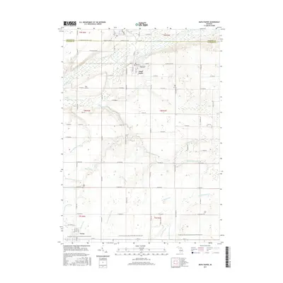
2017 Map of Maple Rapids
USGS Topo · Published 2017About this map
Maple Rapids sits at the center of this agricultural landscape in Clinton County, defined by the winding course of the Maple River. This 2017 study illustrates a deeply established rural drainage system, where numerous named watercourses like Hayworth Creek, Jones Drain, and the Amspoker Drain manage the low-lying terrain. The town of Fowler anchors the southern portion of the map, connected to the surrounding region via the Fred Meijer Clinton-Ionia-Shiawassee (CIS) State Trail, a former railroad corridor converted for modern use. For genealogists, the map is remarkably dense with burial sites, including the Maple Rapids Village Cem, Payne Cem, and several smaller family or local plots such as Beech Cem and Frink Cem. Distinctive landmarks like The Island further characterize the unique topography near the river's edge.
Find a feature on this map
79 named features on this map. Tap any name to fly to it.
Don’t see what you’re looking for? This feature index may not catch every label — zoom into the map to look around manually.
Map Details
Editions of this 2017 Maple Rapids Map
This is the sole edition of this map. No revisions or reprints were ever made.
Other maps of this area

1918 · Perrinton
USGS Topo · 1:62,500

1927 · De Witt
USGS Topo · 1:62,500

1943 · Perrinton
USGS Topo · 1:62,500

1945 · Portland
USGS Topo · 1:62,500

1954 · Midland
USGS Topo · 1:250,000

1958 · Midland
USGS Topo · 1:250,000

1958 · Grand Rapids
USGS Topo · 1:250,000

1959 · Midland
USGS Topo · 1:250,000

1961 · Grand Rapids
USGS Topo · 1:250,000

1962 · Grand Rapids
USGS Topo · 1:250,000