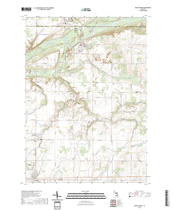
2023 Map of Maple Rapids
USGS Topo · Published 2023About this map
The Maple River flows through the northern reaches of this Clinton County landscape, defining the northern border of the village of Maple Rapids. This settlement serves as a local hub near the Gratiot County line, characterized by a concentration of local landmarks including the Maple Rapids Village Cem and the Po. The surrounding area is defined by an intricate network of agricultural drainage systems, such as the Reynolds and Sessions Drain and Anspoker Drain, which manage the low-lying terrain near The Island.
Find a feature on this map
60 named features on this map. Tap any name to fly to it.
Don’t see what you’re looking for? This feature index may not catch every label — zoom into the map to look around manually.
Map Details
Editions of this 2023 Maple Rapids Map
This is the sole edition of this map. No revisions or reprints were ever made.
Other maps of this area

1918 · Perrinton
USGS Topo · 1:62,500

1927 · De Witt
USGS Topo · 1:62,500

1943 · Perrinton
USGS Topo · 1:62,500

1945 · Portland
USGS Topo · 1:62,500

1954 · Midland
USGS Topo · 1:250,000

1958 · Midland
USGS Topo · 1:250,000

1958 · Grand Rapids
USGS Topo · 1:250,000

1959 · Midland
USGS Topo · 1:250,000

1961 · Grand Rapids
USGS Topo · 1:250,000

1962 · Grand Rapids
USGS Topo · 1:250,000