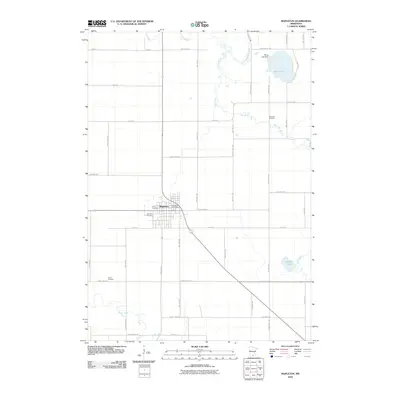
2010 Map of Mapleton
USGS Topo · Published 2010About this map
The agricultural landscape of southern Blue Earth County is centered on the town of Mapleton, where the concentrated grid of streets meets the Mapleton Post Office. This 2010 topographic representation highlights a region defined by its waterway network, with the Cobb River and Little Cobb River winding through the northern reaches, while the Maple River cuts across the southwest. These rivers, along with Perch Lake and Knights Lake, suggest a land historically shaped by drainage and prairie hydrology. For local historians and genealogists, the map is particularly valuable for its documentation of burial sites scattered across the township, including Union Cemetery, Calvary Cemetery, Beauford Cemetery, and Chase Cemetery. The presence of the Perch Lake Dam further illustrates the management of the area's water resources within this predominantly rural, township-and-range surveying system.
Find a feature on this map
46 named features on this map. Tap any name to fly to it.
Don’t see what you’re looking for? This feature index may not catch every label — zoom into the map to look around manually.
Map Details
Editions of this 2010 Mapleton Map
This is the sole edition of this map. No revisions or reprints were ever made.
Other maps of this area

1950 · Mankato East
USGS Topo · 1:62,500

1951 · Mankato East
USGS Topo · 1:62,500

1951 · Mankato West
USGS Topo · 1:62,500

1953 · Saint Paul
USGS Topo · 1:250,000

1953 · New Ulm
USGS Topo · 1:250,000

1954 · Fairmont
USGS Topo · 1:250,000

1954 · Mason City
USGS Topo · 1:250,000

1957 · New Ulm
USGS Topo · 1:250,000

1957 · Mason City
USGS Topo · 1:250,000

1958 · New Ulm
USGS Topo · 1:250,000