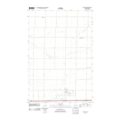
2011 Map of Mapleton
USGS Topo · Published 2011About this map
Mapleton and the surrounding Cass County prairie appear in this 2011 survey as a landscape defined by precise section lines and meandering watercourses. The town of Mapleton sits at the intersection of Meridian Rd and County Rd-10, serving as a central hub for the agricultural region. Local landmarks such as the Mapleton Cemetery on the edge of town provide important touchpoints for family historians. To the north, the small settlements of Prosper and Newman are positioned along the grid of gravel and paved roads. The terrain is shaped by the winding paths of the Maple River, which snakes across the southern portion of the sheet, and the multiple branches of the Rush River, including the Lower Branch Rush River. These waterways offer a stark natural contrast to the rigid geometry of the surrounding road network, such as 164th Ave SE and 37th St SE.
Find a feature on this map
30 named features on this map. Tap any name to fly to it.
Don’t see what you’re looking for? This feature index may not catch every label — zoom into the map to look around manually.
Map Details
Editions of this 2011 Mapleton Map
This is the sole edition of this map. No revisions or reprints were ever made.
Other maps of this area

1895 · Fargo
USGS Topo · 1:125,000

1895 · Casselton
USGS Topo · 1:125,000

1897 · Fargo
USGS Topo · 1:125,000

1897 · Casselton
USGS Topo · 1:125,000

1952 · Grand Forks
USGS Topo · 1:250,000

1953 · Fargo
USGS Topo · 1:250,000

1956 · Fargo
USGS Topo · 1:250,000

1956 · Grand Forks
USGS Topo · 1:250,000

1959 · South West Fargo
USGS Topo · 1:24,000

1959 · West Fargo
USGS Topo · 1:24,000