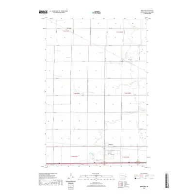
2020 Map of Mapleton
USGS Topo · Published 2020About this map
Mapleton serves as the primary hub in this portion of Cass County, situated where the Maple River meanders across the prairie. The landscape is defined by the rigid grid of the Public Land Survey System, with township lines such as t139n r50w and t140n r51w partitioning the agricultural expanse. Beyond the main settlement, smaller locales like Prosper and Newman anchor the northern reaches of the quadrangle. Local heritage is preserved at the Mapleton Cem, while the drainage of the Red River Valley is traced by the Rush River and its various channels, including the Lower Br Rush River. The map illustrates a contemporary rural environment where modern street names like Sequoia Dr and Carl Olsen St intersect with long-established section roads and intriguing local markers like Un Grave Rd.
Find a feature on this map
29 named features on this map. Tap any name to fly to it.
Don’t see what you’re looking for? This feature index may not catch every label — zoom into the map to look around manually.
Map Details
Editions of this 2020 Mapleton Map
This is the sole edition of this map. No revisions or reprints were ever made.
Other maps of this area

1895 · Fargo
USGS Topo · 1:125,000

1895 · Casselton
USGS Topo · 1:125,000

1897 · Fargo
USGS Topo · 1:125,000

1897 · Casselton
USGS Topo · 1:125,000

1952 · Grand Forks
USGS Topo · 1:250,000

1953 · Fargo
USGS Topo · 1:250,000

1956 · Fargo
USGS Topo · 1:250,000

1956 · Grand Forks
USGS Topo · 1:250,000

1959 · South West Fargo
USGS Topo · 1:24,000

1959 · West Fargo
USGS Topo · 1:24,000