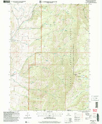
2005 Map of Mapleton
USGS Topo · Published 2007About this map
The Cub River Canal and Middle Ditch define the irrigation-based agriculture that sustains the valley floor between Mapleton and Cherryville. This 2005 revision highlights the complex water management system drawing from the Cub River to support small settlements along the western edge of the quadrangle. As the land rises sharply to the east, the map transitions into the high-elevation terrain of the Cache National Forest, administered locally by the Caribou National Forest. Significant topographical landmarks like Andrew Wilderness Peak and Nyman Mountain dominate the skyline, while numerous springs—such as Baker Spring and Aspen Spring—feed the drainages that descend into the lower fields. For genealogists and local historians, the Mapleton Cem and the solitary Prospect mine symbol provide tangible links to the community's early residents and historical land use at the foot of the Bear River Range.
Find a feature on this map
44 named features on this map. Tap any name to fly to it.
Don’t see what you’re looking for? This feature index may not catch every label — zoom into the map to look around manually.
Map Details
Editions of this 2005 Mapleton Map
This is the sole edition of this map. No revisions or reprints were ever made.
Other maps of this area

1914 · Logan
USGS Topo · 1:125,000

1915 · Preston
USGS Topo · 1:96,000

1916 · Logan
USGS Topo · 1:125,000

1918 · Preston
USGS Topo · 1:125,000

1954 · Ogden
USGS Topo · 1:250,000

1955 · Preston
USGS Topo · 1:250,000

1958 · Ogden
USGS Topo · 1:250,000

1958 · Preston
USGS Topo · 1:250,000

1960 · Ogden
USGS Topo · 1:250,000

1962 · Preston
USGS Topo · 1:250,000