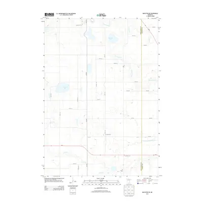
2013 Map of Mapleton NE
USGS Topo · Published 2013About this map
The Little Cobb River and Cobb River meander through this agricultural landscape on the border of Blue Earth and Waseca counties. The area is defined by its rural cemetery network, including Medo Center Cem, Medo Cem, Danville Cem, Saint John's Cem, and Catholic Cem, which serve as vital landmarks for genealogists tracing early families in the region. The map captures the hydrography of the prairie, showing Cottonwood Lake and Severson Lake alongside man-made water management features like Judicial Ditch Number Fiftyone. A rigid grid of township roads and county highways, such as MN-30 and MN-83, organizes the farmsteads and connects these small rural hubs, reflecting a late-twentieth-century shift in rural infrastructure while preserving the locations of historic burial grounds.
Find a feature on this map
37 named features on this map. Tap any name to fly to it.
Don’t see what you’re looking for? This feature index may not catch every label — zoom into the map to look around manually.
Map Details
Editions of this 2013 Mapleton NE Map
This is the sole edition of this map. No revisions or reprints were ever made.
Other maps of this area

1950 · Mankato East
USGS Topo · 1:62,500

1951 · Mankato East
USGS Topo · 1:62,500

1953 · Saint Paul
USGS Topo · 1:250,000

1954 · Mason City
USGS Topo · 1:250,000

1957 · Mason City
USGS Topo · 1:250,000

1958 · Mason City
USGS Topo · 1:250,000

1959 · Saint Paul
USGS Topo · 1:250,000

1966 · Janesville
USGS Topo · 1:24,000

1967 · Minnesota Lake
USGS Topo · 1:24,000

1967 · Waldorf
USGS Topo · 1:24,000