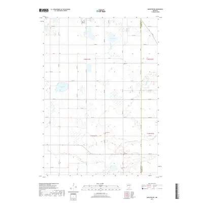
2019 Map of Mapleton NE
USGS Topo · Published 2019About this map
The agricultural landscape of Blue Earth County is defined by its complex drainage network and the quiet presence of early pioneer legacy. The Cobb River and Little Cobb River meander through the prairie, joined by smaller tributaries like Bull Run Cr and man-made alterations such as Judicial Ditch Number Fiftyone. These watercourses dictate the placement of farms and cemeteries that serve the surrounding rural community. Genealogists will find a cluster of burial grounds marking early settlement nodes, including Medo Center Cem, Danville Cem, and Saint John's Cem. Large bodies of water like Cottonwood Lake and Severson Lake break up the grid of section lines and county roads, while the Blue Earth County and Waseca County border runs along the eastern edge, delineating the jurisdictional boundaries of these southern Minnesota townships.
Find a feature on this map
63 named features on this map. Tap any name to fly to it.
Don’t see what you’re looking for? This feature index may not catch every label — zoom into the map to look around manually.
Map Details
Editions of this 2019 Mapleton NE Map
This is the sole edition of this map. No revisions or reprints were ever made.
Other maps of this area

1950 · Mankato East
USGS Topo · 1:62,500

1951 · Mankato East
USGS Topo · 1:62,500

1953 · Saint Paul
USGS Topo · 1:250,000

1954 · Mason City
USGS Topo · 1:250,000

1957 · Mason City
USGS Topo · 1:250,000

1958 · Mason City
USGS Topo · 1:250,000

1959 · Saint Paul
USGS Topo · 1:250,000

1966 · Janesville
USGS Topo · 1:24,000

1967 · Minnesota Lake
USGS Topo · 1:24,000

1967 · Waldorf
USGS Topo · 1:24,000