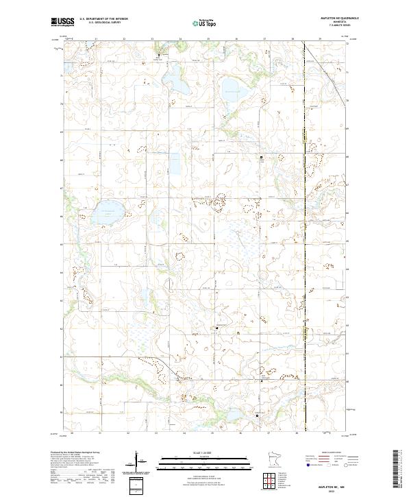
2022 Map of Mapleton NE
USGS Topo · Published 2022About this map
Agricultural lands along the Blue Earth Co and Waseca Co line define this part of southern Minnesota. The landscape is carved by the winding Little Cobb River and its larger counterpart, the Cobb River, which move through a mosaic of wetlands and small basins. Significant water bodies like Severson Lake and Cottonwood Lake sit among a grid of section-line roads, such as Co Rd 14 and Co Rd 21. For genealogists and local historians, the map is a valuable record of rural burial sites, including Medo Center Cem, Danville Cem, and Saint John's Cem. The intricate network of drainage, exemplified by Judicial Ditch Number Fiftyone, illustrates the intensive management of this fertile prairie region for modern production.
Find a feature on this map
66 named features on this map. Tap any name to fly to it.
Don’t see what you’re looking for? This feature index may not catch every label — zoom into the map to look around manually.
Map Details
Editions of this 2022 Mapleton NE Map
This is the sole edition of this map. No revisions or reprints were ever made.
Other maps of this area

1950 · Mankato East
USGS Topo · 1:62,500

1951 · Mankato East
USGS Topo · 1:62,500

1953 · Saint Paul
USGS Topo · 1:250,000

1954 · Mason City
USGS Topo · 1:250,000

1957 · Mason City
USGS Topo · 1:250,000

1958 · Mason City
USGS Topo · 1:250,000

1959 · Saint Paul
USGS Topo · 1:250,000

1966 · Janesville
USGS Topo · 1:24,000

1967 · Minnesota Lake
USGS Topo · 1:24,000

1967 · Waldorf
USGS Topo · 1:24,000