
1942 Map of Mappsville
USGS Topo · Published 1962About this map
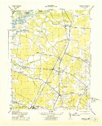
The coastal plains of Accomack County during the early 1940s are defined here by a series of agricultural necks and narrow saltwater inlets. The Pennsylvania railroad line serves as the primary spine for settlement, connecting inland hamlets like Bloxom and Mears Station to the broader regional economy. Family-named landmarks such as Whites Neck, Gargathy Neck, and Parker Neck stretch toward the Atlantic, separated by the waters of Gargathy Bay and Kegotank Bay. These low-lying areas reflect a landscape shaped by traditional water-access boundaries and small-scale farming.
Find a feature on this map
63 named features on this map. Tap any name to fly to it.
Don’t see what you’re looking for? This feature index may not catch every label — zoom into the map to look around manually.
Map Details
Editions of this 1942 Mappsville Map
This is the sole edition of this map. No revisions or reprints were ever made.
Other maps of this area

1931 · Accomac
USGS Topo · 1:48,000

1935 · Accomac
USGS Topo · 1:62,500

1942 · Wallops Island
USGS Topo · 1:24,000

1942 · Saxis
USGS Topo · 1:24,000

1942 · Parksley
USGS Topo · 1:24,000

1943 · Parksley
USGS Topo · 1:31,680

1943 · Saxis
USGS Topo · 1:31,680

1943 · Mappsville
USGS Topo · 1:31,680

1943 · Chincoteague West
USGS Topo · 1:31,680
1943 · Hallwood
USGS Topo · 1:31,680