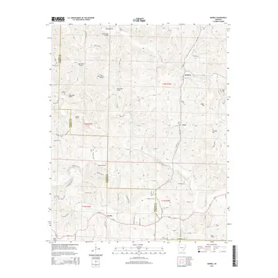
2014 Map of Marble
USGS Topo · Published 2014About this map
Kings River and the Dry Fork carve through this section of the Ozarks along the Madison and Carroll County line. The settlement of Marble sits at the southern reach of the map, serving as a focal point near the confluence of Big Onion Cr. The landscape is defined by its series of high ridges and deep hollows, including Chinkapin Mtn and Walker Mtn. Smaller communities like Metalton and Dean are situated further north, connected by a network of county roads such as Metalton Ln and Bayberry Ln. Local history is anchored by several rural burial sites, including Dean Cem, White Oak Cem, and Merl Cem, which provide essential points of reference for genealogists tracking family ties in these hills. Numerous named drainages like Piney Cr and Tarkiln Hollow reveal the intricate water systems that have shaped the region's topography and settlement patterns.
Find a feature on this map
93 named features on this map. Tap any name to fly to it.
Don’t see what you’re looking for? This feature index may not catch every label — zoom into the map to look around manually.
Map Details
Editions of this 2014 Marble Map
This is the sole edition of this map. No revisions or reprints were ever made.
Other maps of this area

1900 · Eureka Springs
USGS Topo · 1:125,000

1901 · Eureka Springs
USGS Topo · 1:125,000

1904 · Harrison
USGS Topo · 1:125,000

1905 · Harrison
USGS Topo · 1:125,000

1945 · Harrison
USGS Topo · 1:250,000

1949 · Harrison
USGS Topo · 1:250,000

1954 · Harrison
USGS Topo · 1:250,000

1958 · Harrison
USGS Topo · 1:250,000

1964 · Harrison
USGS Topo · 1:250,000
1968 · Osage
USGS Topo · 1:24,000