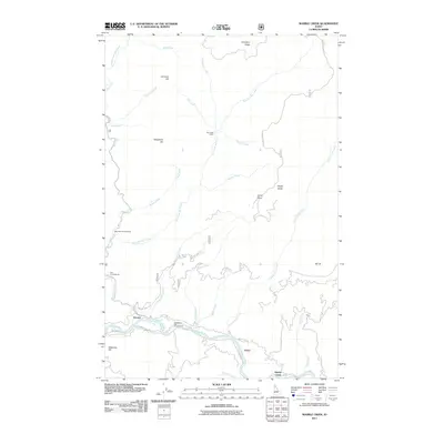
2011 Map of Marble Creek
USGS Topo · Published 2011About this map
The Saint Joe River valley serves as the primary corridor of human activity in this Idaho landscape, where the small settlement of Herrick sits at a junction of river and road. Further east, the locality of Erlmo marks another point of connection along the North Side Rd. The map reveals a high-elevation network of drainage systems, including the complex tributaries of Big Creek and Black Prince Creek, which flow through a terrain punctuated by distinct peaks like Sheep Butte and Maternity Hill.
Find a feature on this map
38 named features on this map. Tap any name to fly to it.
Don’t see what you’re looking for? This feature index may not catch every label — zoom into the map to look around manually.
Map Details
Editions of this 2011 Marble Creek Map
This is the sole edition of this map. No revisions or reprints were ever made.
Other maps of this area

1914 · Avery
USGS Topo · 1:125,000

1917 · Avery
USGS Topo · 1:125,000

1955 · Spokane
USGS Topo · 1:250,000

1956 · Wallace
USGS Topo · 1:250,000

1957 · Wallace
USGS Topo · 1:62,500

1957 · Calder
USGS Topo · 1:62,500

1958 · Spokane
USGS Topo · 1:250,000

1960 · Wallace
USGS Topo · 1:250,000

1969 · Marble Mountain
USGS Topo · 1:24,000
1969 · Hoyt Mountain
USGS Topo · 1:24,000