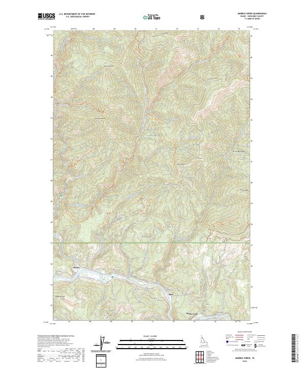
2024 Map of Marble Creek
USGS Topo · Published 2024About this map
The Saint Joe River valley serves as the primary corridor for human activity in this corner of the St Joe National Forest. Small settlements like Herrick, Erlmo, and Marble Creek are situated along the riverbank, tracing a narrow line of development through the steep drainage. A significant historical marker is the Old Milwaukee Road RR Grade, which follows the river's path, indicating the importance of rail transport for the timber or mining industries that once defined this Idaho panhandle region. Higher elevations are marked by landmarks such as Cemetery Ridge and Prince Peak, while the northern portion is dominated by the St Joe Mountains. The land is crisscrossed with numerous specialized paths, including the Daugherty Hill National Recreation Trl and various off-highway vehicle routes like the Mud Cabin-Ohv Trl, reflecting the modern shift toward forest management and recreational use.
Find a feature on this map
61 named features on this map. Tap any name to fly to it.
Don’t see what you’re looking for? This feature index may not catch every label — zoom into the map to look around manually.
Map Details
Editions of this 2024 Marble Creek Map
This is the sole edition of this map. No revisions or reprints were ever made.
Other maps of this area

1914 · Avery
USGS Topo · 1:125,000

1917 · Avery
USGS Topo · 1:125,000

1955 · Spokane
USGS Topo · 1:250,000

1956 · Wallace
USGS Topo · 1:250,000

1957 · Wallace
USGS Topo · 1:62,500

1957 · Calder
USGS Topo · 1:62,500

1958 · Spokane
USGS Topo · 1:250,000

1960 · Wallace
USGS Topo · 1:250,000

1969 · Marble Mountain
USGS Topo · 1:24,000
1969 · Hoyt Mountain
USGS Topo · 1:24,000